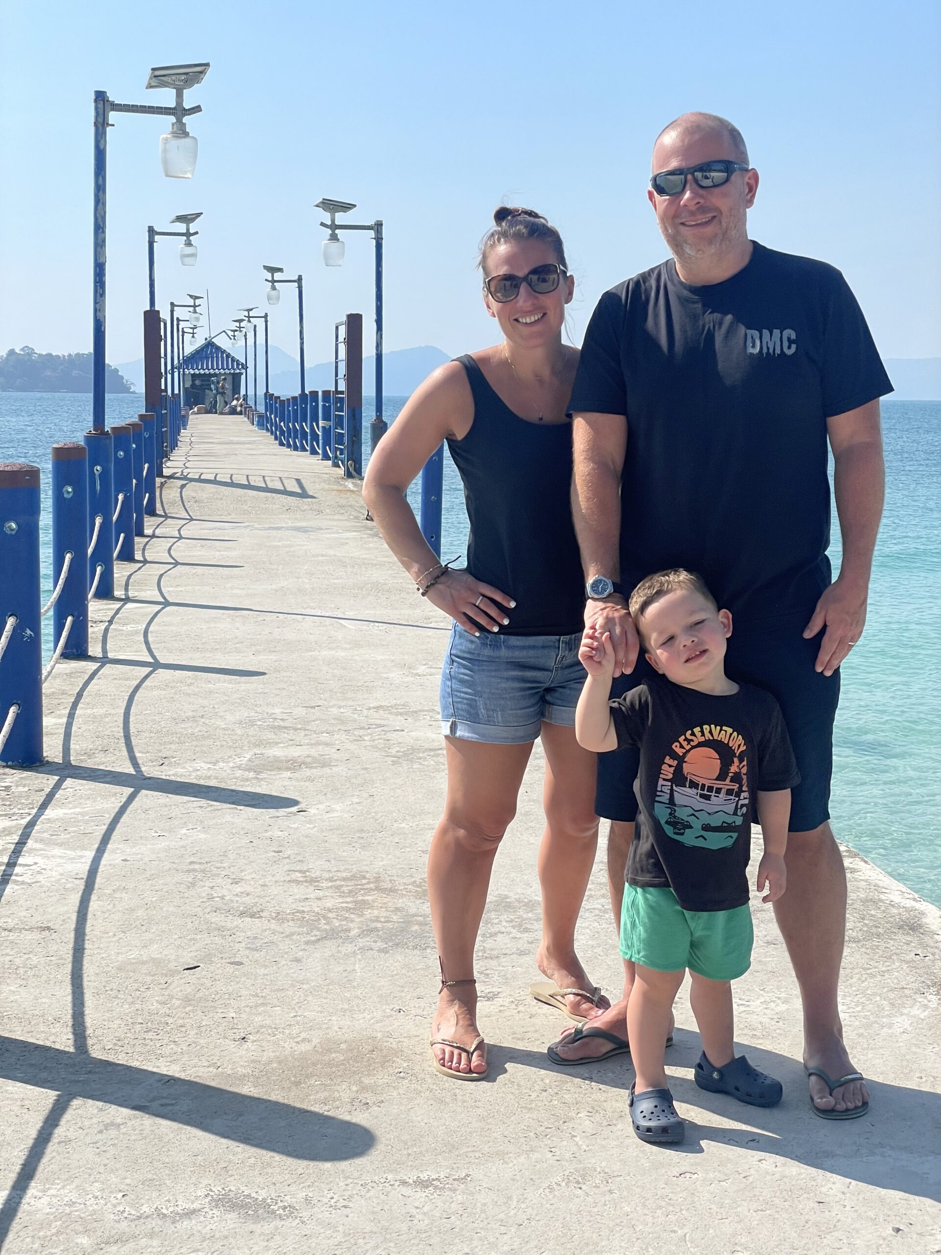
Went to Africa and took a walk up a hill.
August 2016
As with most crazy ideas, it all started in a Dubai bar watching a game of football, we got on to how about trying to climb Kilimanjaro and it went from there.
With all the gear and literally no idea, Matt and his good friend Paul took off to Tanzania in August 2016. We had signed up to do the climb with a Canadian based company Mountain climbing adventures, and we couldn’t have been in better hands.
Having arrived at Dar es Salam, we connected on a domestic flight to Kilimanjaro, this was on small aircraft, and our first sight of the mountain we were about to conquer was seen out of the window of the plane, and we appeared to be flying below the summit, a real reminder of the challenge we were about to face.
We were picked up from the airport by our head guide Respicius Baitwa who turned out to be one of the most experienced Kilimanjaro climbers having been chief guide and having navigated the mountain many times. As we drove through the streets of Kilimanjaro, Respicius turned to me and said, “do you have any experience of climbing mountains” the answer was no, then he asked, “how much training have you done”, living in Dubai at the time, the answer was limited, and no hills. He just gave us a look, and it suddenly clicked what we had signed ourselves up for, this wasn’t going to be easy.
We spent the first couple of days in the town of Moshi, we met up with our co climbers, in total there would be 5 of us climbing (living) together for the next week or so. We had a weight limit on our stuff, and Respicius was meticulous in checking our kit, to ensure we had what we needed, as once you are on the mountain there is no going back.
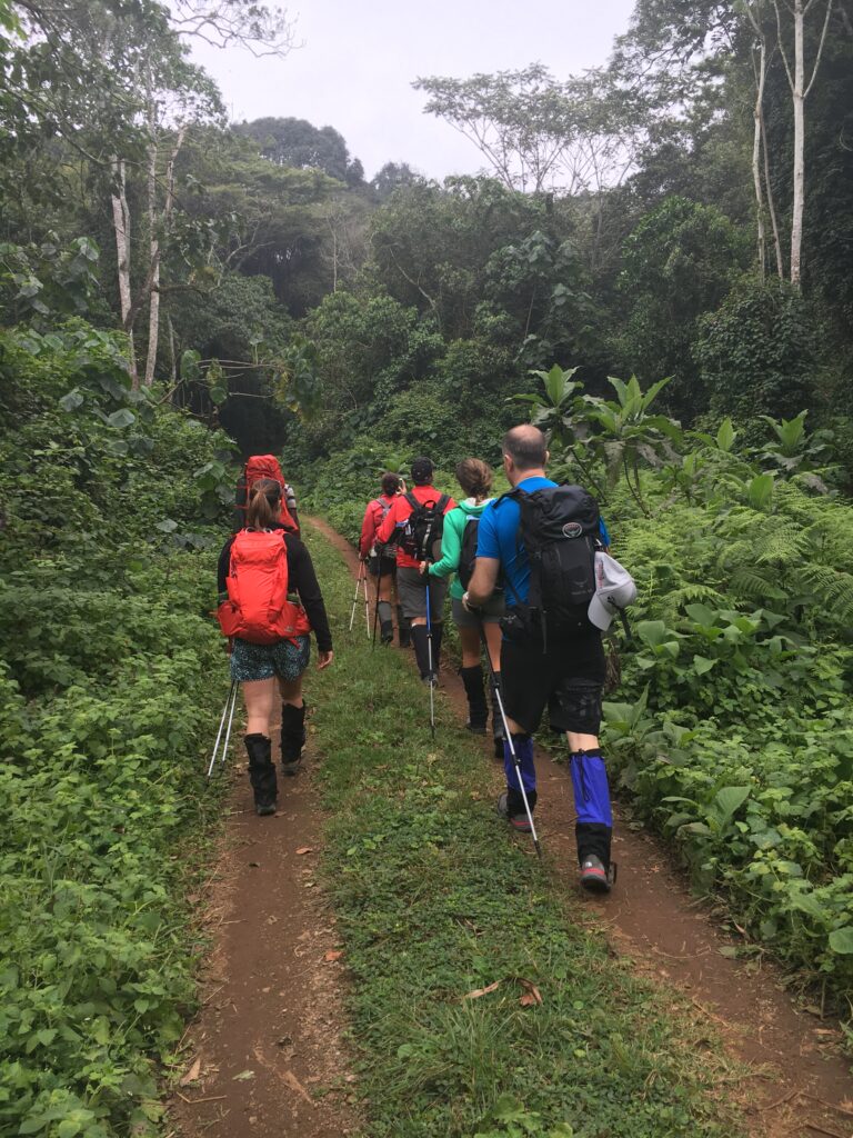
In the spirit of not doing anything easily, we took the infamous Umbwe route. Which is cited as the hardest and most challenging of all the routes, it’s a steep route, and once that provides faster altitude changes therefore increasing the risk of failure. However, it is the quietest and may have some of the best scenery. We were in Respicius hands and trusted him to get us to summit.
This is our journey
Day 1 UMBWE GATE TO UMBWE CAVE. Altitude: 9700ft /2950m – Hike: 11km
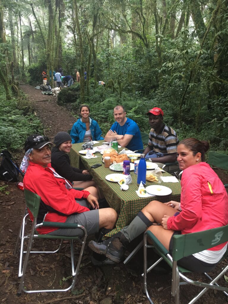
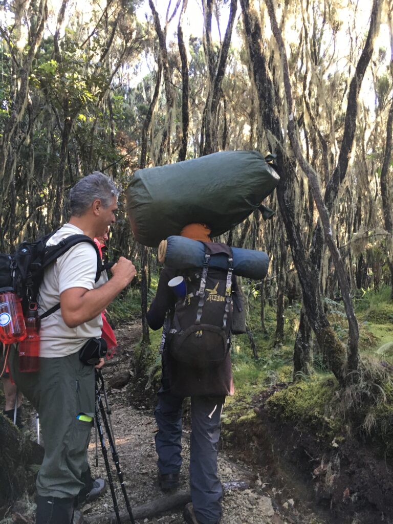
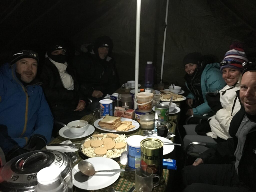
We were off, we were picked up and our bags loaded on the roof of the bus, we drove towards the mountain that was going to be home for the next week. Arriving at the Umbwe gate, is the start of the adventure, you have to complete some paperwork, obtain permits and then we started walking. It is surprising how green this stage of the mountain is, you are walking through rain forest, and it was misty, damp and not warm at all. We were entertained by a group of monkeys following us and swinging through the trees. As we walked and it got closer to lunch, we turned a corner and the dining table was set up in the middle of the jungle ready for us to dine, this became the first of many feasts our wonderful guides would cook up for us during our adventure. After lunch we continued to trek to our base for the first night, which was the Umbwe cave. As we learnt our team would leapfrog us with our luggage and tents, so every stage of our trip our base was always set up for us upon arrival. I am still in awe of the team and how fast they move up the mountain carrying literally hundreds of kilograms with them!
DAY 2 – UMBWE CAVE TO BARRANCO CAMP – Altitude: 13000ft / 3950m – Hike: 4m/6km
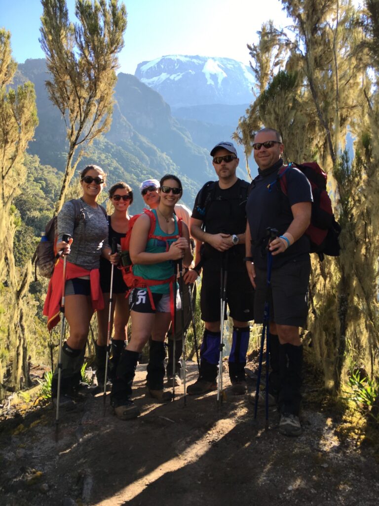
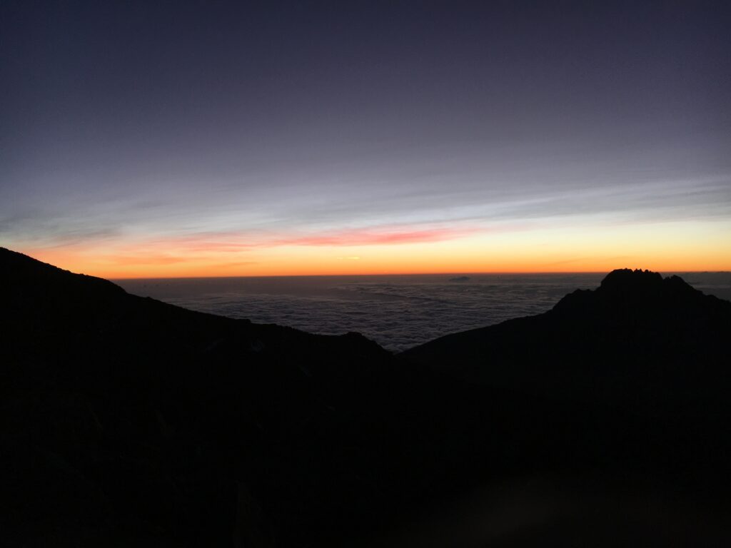
Being woken up after the first night on the mountain is a great experience, you survived, not too cold and there is a cup of coffee at your tent door ready. This is the time you realise that washing for the next few days may be a luxury, not because of a lack of water but just easier not to! We continued to walk through the forest today, this was the day we finally got our first view of the summit, because of cloud, mist and vegetation we didn’t see it the day before, but today we saw the goal! As we climbed, we were suddenly above the cloud, which is a breathtaking view that never gets boring. We then remained above the clouds for the majority of the rest of the time on the mountain. We ended up at the Barranco Hut. It was amazing to see the unique environmental differences that characterize this equatorial zone.
DAY 3 – GREAT BARRANCO WALL
One of the risks with this route is the high change in altitude and while the tablets can help, they aren’t always enough. As such our itinerary allowed for an acclimatization day, so we stayed at the Barranco Hut for two nights. We spent the day climbing up to over 14,500ft’ around the Great Barranco valley and then drop back to 13000ft. We spent a lot of time marveling at being above the clouds.
Day 4 – BARRANCO CAMP TO KARANGA CAMP Altitude: 13104ft / 3995m – Hike:3 miles/5km
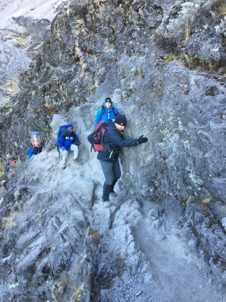
We spend this extra day helping acclimatize to the altitude. Our first challenge of the day is to breach the Barranco Wall – not too tough, but a challenge, nonetheless. At points you are facing the wall, walking on a ledge about 12 inches wider. Most of the day is spent skirting the base of Kibo peak over our left shoulder. We descended into the Karanga Valley, and climbed up the other side, where we rested up for the night before the tough climb up to Barafu hut. Lunch, dinner and overnight at Karanga camp. At this stage all vegetation has disappeared and the route is rocky and dusty, it is just too high and cold for anything to survive for long up in the Alpine zone.
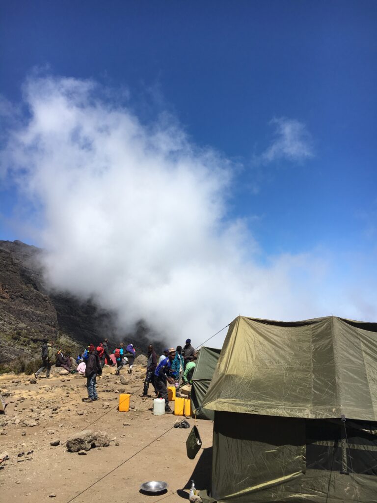
Day 5 – KARANGA CAMP TO BARAFU CAMP – Altitude: 15088f1/4600m – Hike 2 miles/3.5km
The air starts getting quite thin, and you will be running short of breath. It’s a tough, but a rewarding uphill climb to the rocky, craggy slopes at the camp. “Barafu” means, “ice” in Swahili, and it is extremely cold at this altitude. We arrived here relatively early. This was an important part of our plan, as we needed to hike up a thousand feet from camp, so we can acclimatize at around 16,000 fl, before we climb to the crater tonight. However, upon arrival at Barafu camp, our guides consulted the weather, and it wasn’t good news. It was windy and cold, so we continued to push on for about another hour and camped closer to the summit. In hindsight this decision was probably the difference between us summitting or not. If we had stayed with the original plan, we would have had to leave at midnight to make the climb to the summit. Getting this much further ahead meant we were able to start later and avoid some of the hardest climbing in the dark and cold. Even still we had another feast, and went to bed early ready for the 3am start and the final leg to Uhuru Peak. Lunch, dinner and overnight at Barafu camp.
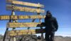
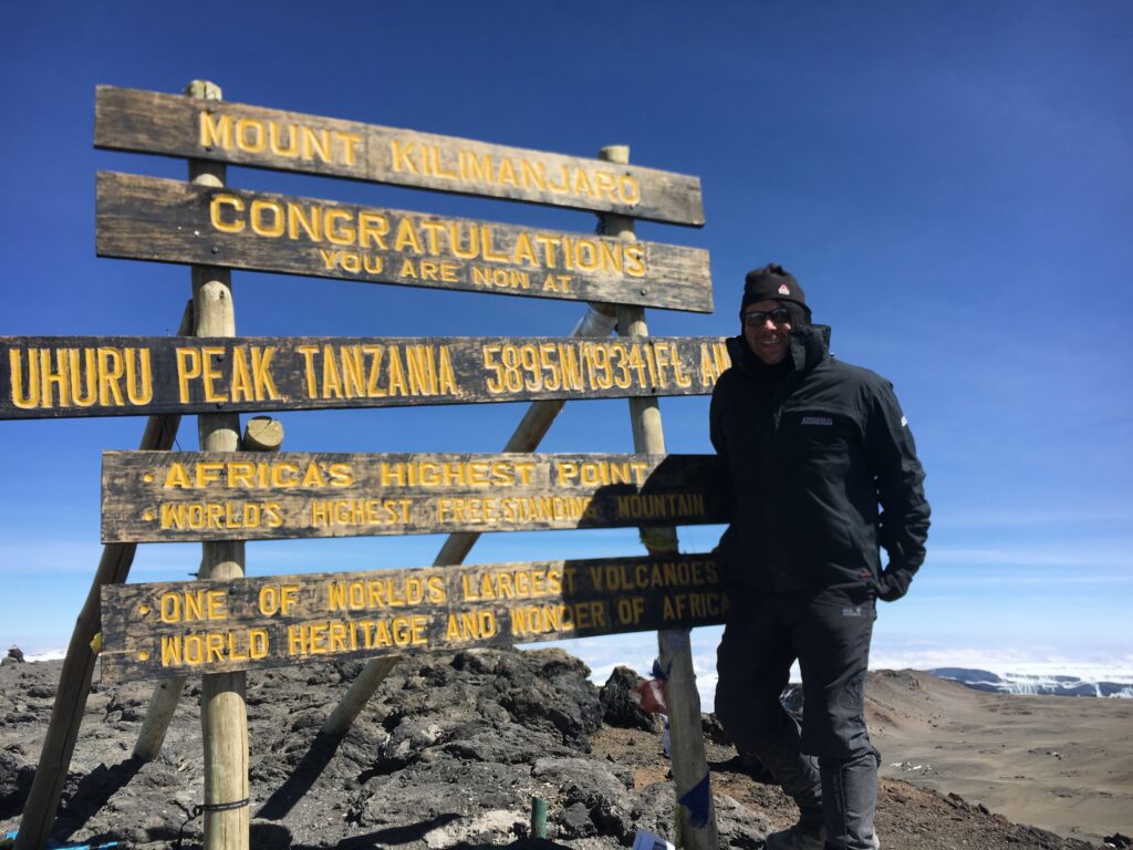
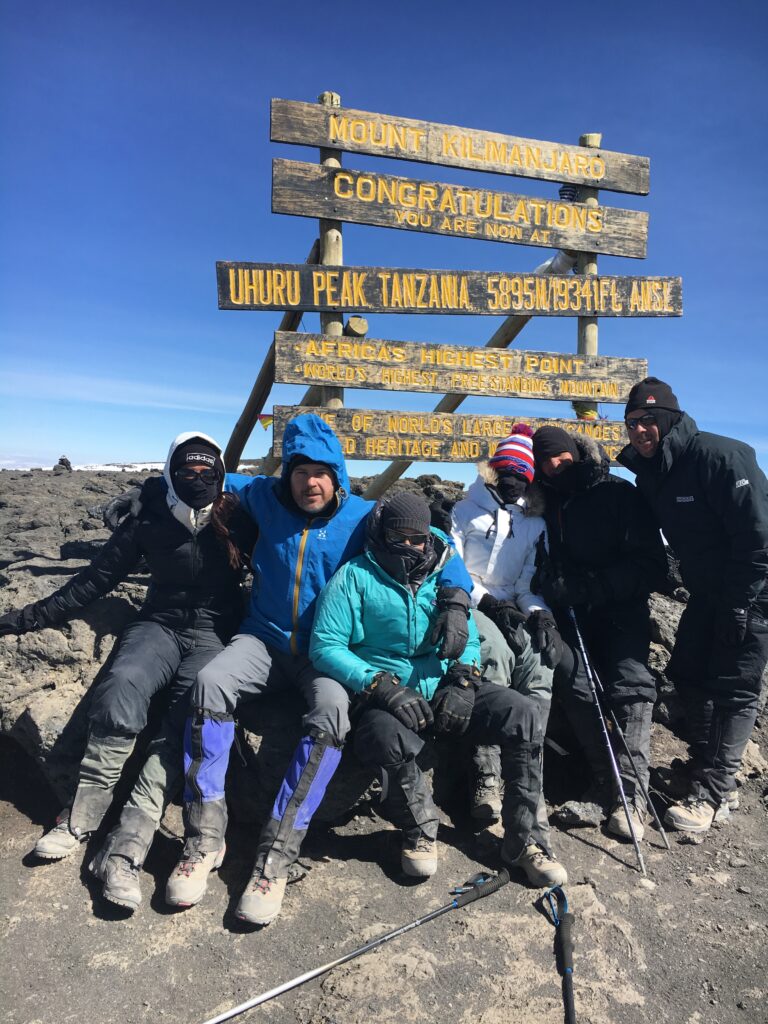
Day 6 – BARAFU to UHURU to MILLENNIUM CAMP – 19341f1/5895m – 4 miles/6km – 12490f03808m – 1.5miles/2.5km
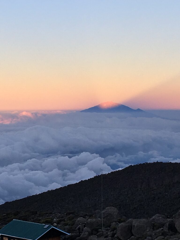
Being honest this day was a complete blur, but the photos and timings of these allows me to piece it all together. We woke at 3am, had a hearty breakfast and started walking just before 4am, the plan was we would summit at sunrise. However it was so very cold and windy, so windy that our guides had said they had not seen conditions like this for many years. Altitude was taking affect in the group, light headedness, headaches, and just the ability to walk half steps (polepole polepole) was difficult. As we left our isolated camp we saw torches from climbers who will hopefully summit before us. Along the route we didn’t know if we would make it, the distance wasn’t far, but with every step the air got thinner, and our bodies reacted to it. The risk of failure increased as we passed more and more people who were hit with altitude sickness, and had to abort their summit day. We followed a picturesque back route for our final ascent accessing an exclusive and rarely utilized summit footpath that offers access to isolated and undefiled natural areas and remarkable views of east Africa’s peaks and plains. With views of Kenya to the North and Tanzania to the south, this rare vision has been seen by few and is a lifetime treasure, and it didn’t disappoint as the sun rose.
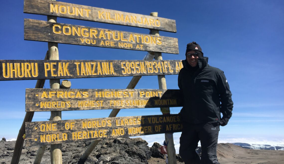
We climbed and the conditions worsened. We hiked around the crater rim, and got our first glance of the glacier. We then left the crater rim and hiked to the top of Uhuru Peak. From here it is just a ten-minute hike to Uhuru Summit it felt like days, the highest point in Africa at 19,340 feet! All in all we didn’t arrive at the summit until 10am, which was several hours later than planned. Our group was suffering, so we didn’t spend long at the summit, some photos and we were off. After our summit celebration we began our descent past Barafu Hut and down to Millennium Camp. A celebratory feast was served, but the elation of achiving our goal, and the fact that oxygen was aplenty at this altitude meant the celebrations began. In all we descended 9,000 feet, and as such we felt intoxicated by the oxygen-rich air!
DAY 7 – FINAL DESCENT Altitude 5380ft / 1640m – Hike 6m/10km
After taking days to hike up, you end up getting down in one day, in same senses this is more difficult, as you are hiking downhill and going fairly fast. Once we had descended the 4,500 feet to the road head, we had our last lunch with our guides and team, this was a very emotional time, these people had helped and fed us all week, we ended up gifting most of our kit to the team, where they have a raffle for the thing that they will get so much use from.